


Galtee Mountains

mlmoroneybb
User
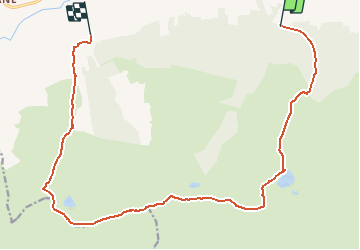

Length
15.9 km

Max alt
911 m

Uphill gradient
1031 m
Km-Effort
30 km

Min alt
115 m

Downhill gradient
1052 m
Boucle
No
Creation date :
2014-12-10 00:00:00.0
Updated on :
2014-12-10 00:00:00.0
--
Difficulty : Very difficult

FREE GPS app for hiking
 SityTrail
IGN / Geographical institutes
SityTrail Plus
The world is yours!
About
Trail Walking of 15.9 km to be discovered at Unknown, County Tipperary, The Municipal District of Cahir — Cashel. This trail is proposed by mlmoroneybb.
Description
5 Lakes view on 6 Mountain peaks in the galtees
Positioning
Country:
Ireland
Region :
Unknown
Department/Province :
County Tipperary
Municipality :
The Municipal District of Cahir — Cashel
Location:
Templeneiry
Start:(Dec)
Start:(UTM)
559721 ; 5806579 (29U) N.
Comments